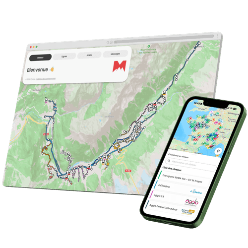
Why Invest in Passenger Information?
A network that keeps passengers informed attracts and retains them. Pysae Passenger goes live in 8 weeks, built on your data and carrying your brand.
Built on your data
Works with GTFS and NeTEx: your existing standard file is all it needs. No infrastructure to manage, no proprietary format.
Real-time by design
Paired with Pysae AVM, Passenger publishes positions, delays and deviations every 5 seconds over GTFS-RT.
Your brand, everywhere
White-label web interface available from the Standard tier. Your colours, logo and name on your website, screens and QR codes.
What Does a Complete Passenger Information System Include?
From the interactive network map to the journey planner and local points of interest: everything passengers need, in one system.
Interactive map & timetables
Every route and stop on one map. Next departures for today and the next 7 days, from any stop.
Passenger alerts & push notifications
Strikes, roadworks, deviations: schedule alerts in advance, with cause and effect fields. Push notifications arrive even when the app is closed. GTFS-RT and SIRI compatible.
QR codes at stops
Instant timetable access, no download needed. One scan opens passenger information in the browser. No barrier to use.
Journey planner
Door-to-door journeys with connections. Multimodal routing, address autocomplete. No dependency on Google Maps: your data, your terms.
Local Points of Interest (POI)
Town hall, markets, events: guide passengers to their destination with the "Get there by bus" button. Corrects Google Maps errors on local routes.
iFrame & MaaS integration
Display passenger information on your website, kiosks or partner apps. SIRI connector plus Google Maps and Instant System integrations included.
Stop screens & onboard displays
Dedicated interface for roadside and onboard screens: next departures, destinations, bays, live traffic alerts. Optional bus station connector.
SIRI connector & GTFS-RT feed
Full interoperability: Stop Monitoring, General Message and Vehicle Monitoring, in request/response mode. Deviations included via GTFS-RT TripModifications.
A Complete Passenger App from Pysae
Included from the Essential tier, the Pysae Info app is the fastest way to modernise passenger information. Within 8 weeks, passengers have your entire network on iOS and Android.


3 Tiers, One Platform
Start with the essentials. Scale up when you're ready. Pysae adapts to the size of your network.
Essential
5 routes · 5,000 sessions/month
- ✓Network map & next departures
- ✓Passenger information messages
- ✓QR code timetable access
- ✓Pysae passenger web interface
- ✓GTFS-RT & Google Maps
- ✓Stop screen interface
Standard
20 routes · 20,000 sessions/month
- ✓Everything in Essential +
- ✓Real-time waiting times
- ✓Current deviations displayed
- ✓White-label web interface
- ✓Remote passenger information
- ✓QR code per stop
- ✓Onboard passenger information connector
- ✓Advanced push notifications
Premium
50 routes · 50,000 sessions/month
- ✓Everything in Standard +
- ✓Journey planner
- ✓Local points of interest (50 POIs)
- ✓SIRI connector
- ✓Bus station connector
- ✓ITxPT onboard standard
- ✓Full white label (web + screens + QR)
An Infrastructure Built for Public Transport
Pysae manages the entire technical stack. You retain full control over your data and brand identity.
GTFS & GTFS-RT
Automatic import of your transport plan. Real-time feed every 5 seconds, 100% specification-compliant.
Native connectors
Google Maps, Instant System, regional multimodal information systems, SIRI, SIRI-ET, bus station connector, onboard passenger information: certified integrations.
Data sovereignty
Your passenger data does not pass through third parties. No Google Maps dependency. NeTEx export included.
Resilient cloud
AWS multi-AZ architecture, Kubernetes with autoscaling. RTO ≤ 4h, RPO ≤ 1h. Premium SLA available on the Enterprise plan.